
Port Huron ZIP Code Coverage
Port Huron address research begins with two delivery designations documented by the postal sources. ZIP 48060 is the standard street-delivery ZIP when USPS confirms the particular address. ZIP 48061 is used for the Port Huron post-office and box-delivery designation. Neither label maps every city or county boundary. The relevant ZIP for a real address must come from a live USPS result, not from the city name printed on a historic record.
| ZIP Code | Areas Covered | Post Office | Notes |
|---|---|---|---|
| 48060 | Standard Port Huron street-delivery addresses when USPS confirms the address | USPS address lookup | Delivery geography, not a city-limit finding |
| 48061 | Port Huron post-office and box-delivery designation | Port Huron Post Office | Do not assume every city street uses this ZIP |
The research did not establish a complete delivery-boundary line for every neighboring address. That is why the Port Huron ZIP code directory treats ZIPs as mailing designations and directs a boundary-sensitive search to USPS, the Census map, and county GIS together.
The Port Huron Post Office page identifies the office at 852 32nd St., Port Huron, MI 48061-9998, with retail hours that differ by weekday and Saturday. That address is useful for postal service questions, but it should not be copied into a property or voter search as a substitute for the address being researched. Delivery status comes from the actual address query, while the city or county record keeps its own jurisdiction and parcel fields.
Using USPS for Port Huron ZIP Codes
The USPS ZIP Code Lookup is the address-standardization source. It offers an address search, a city-and-state search, and a cities-by-ZIP search. Use the address route for a known street address, then preserve USPS's returned spelling and ZIP beside the historic wording found in a directory, deed, or obituary. That two-column practice keeps modern delivery formatting from replacing the source text.
| USPS search mode | Useful Port Huron question |
|---|---|
| By address | Which delivery ZIP and formatted street address USPS returns. |
| By city and state | Which mailing associations USPS lists for Port Huron, Michigan. |
| Cities by ZIP | Which city and state association is returned for a known ZIP. |
The USPS lookup screen is the practical first check for a delivery ZIP.
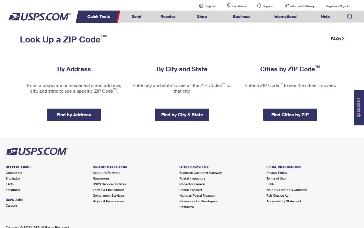
The result can normalize a mailing address, but it does not identify a parcel owner, city jurisdiction, or election district.
Port Huron ZIP Code Geography
A Port Huron mailing line is not proof that a parcel is inside the incorporated city. The Census BAS map is the municipal-boundary reference, while the county GIS supplies the parcel polygon. ZIP, ward, school district, neighborhood association, and city limits are separate map layers. A reader comparing addresses near water, bridge approaches, or the city edge should keep the result of each system in a separate note.
For a boundary-sensitive Port Huron question, record four outputs rather than merging them into one label: the USPS delivery ZIP, the county parcel jurisdiction, the incorporated boundary on the Census map, and the city zoning or street-map context. The same mailing address can be useful in all four systems, but each system answers a different legal or geographic question. This matters before sending a city request, checking a parcel, or comparing a historic directory entry with a current address.
Records geography. A mailing ZIP can help format an address, but it cannot establish city jurisdiction. Pair USPS with the Census boundary and county GIS before making a location-based records request.
Finding Port Huron Records by ZIP Code
A ZIP code can narrow the place to check, but the principal local record systems use different keys. The county property form uses owner name, street number, street name, or parcel number, one criterion at a time. County GIS accepts parcel ID or street name in its Parcel Viewer. Michigan's MVIC asks for ZIP as part of an individual lookup, while a Qualified Voter File request requires one geography selected on the state form. The Port Huron ZIP code directory is therefore an orientation tool, not a bulk resident list.
- Run the known street address through USPS and save the returned ZIP and standardized spelling.
- Search the county property form by street number and street name, or use a parcel number already known.
- Open the parcel in county GIS to check its mapped location and adjacent parcel context.
- For election information, identify the appropriate city, ward, precinct, or other requested geography instead of treating the ZIP as a precinct.
Once a ZIP check has narrowed the address, the Port Huron street directory handles the address-to-parcel and recorded-instrument trail in more detail.
Port Huron ZIP Code Election Limits
Michigan voter records are public subject to exemptions, but the access channel matters. MVIC is designed around a person's own registration, polling place, sample ballot, clerk, and ballot-tracking information. Its name route asks for first name, last name, birth month, birth year, and ZIP. It is not a public name-browse directory. A QVF request uses a controlled form and requires a single geography, such as city or ward/precinct, with requested history and delivery choices.
Public voter fields do not include all submitted information. Driver-license or state-ID data, month and day of birth, phone, email, and other protected details have exemptions. A ZIP field never removes those limits.
The QVF request form also asks the requester to choose a delivery method and format. Electronic data is not delivered by email under the form's stated instructions, and added election history can increase cost. Select only the geography and history needed for a legitimate records question. Treat a city, ward, precinct, school district, and ZIP as different choices, even when they share part of the same mailing area.
Historic Port Huron Address Variants
Older Port Huron records can use rural routes, township names, an unnumbered street, or a former street name. The 1950–51 directory shows street-and-road and alphabetical departments, rural-delivery context, and period abbreviations. Keep the address exactly as printed, then add a second normalized field after checking USPS. Search sensible variants such as numbered versus spelled-out streets and Avenue versus Ave. rather than forcing an old record into a modern ZIP code.
For downtown and river-adjacent research, add a current street map, county parcel number, and the historic legal description to the note. Bridge approaches and road alignment can make a seemingly familiar address ambiguous.
Port Huron ZIP Code Research Notes
A useful Port Huron ZIP code note preserves five separate fields: the historic address wording, the current normalized street, the parcel number, the city or township jurisdiction, and the ZIP returned by USPS. Add a ward, precinct, or neighborhood only when a dated official map supports it. This modest evidence trail makes it clear whether a difference came from delivery formatting, a boundary, or a historic street change.
The county GIS page explains that original Parcel Search accepts one of name, street name, street number, or parcel ID. Its Parcel Viewer can search parcel ID or street name and includes layers, print, export, share, measure, and markup tools. Record the map-layer date with any parcel observation because the public layer is not a permanent historical snapshot.
County property instructions also warn that tax displays can reflect delinquent years, recalculated interest, or time-sensitive payment information. A ZIP result cannot validate a tax balance, ownership status, or municipal record. Save the source URL, search date, exact address, parcel number, and any map-layer date so a later reviewer can tell which system supplied each fact.
ZIP Code Boundaries and Port Huron Limits
The Port Huron ZIP code directory cannot substitute for a jurisdiction check. Use USPS for delivery, the city indexed street map for local orientation, county GIS for the parcel, and the Census BAS map for incorporated limits. These sources can all be correct while answering different questions. A precise request to a city office should use the city jurisdiction and parcel context, not only the postal city name.
The Port Huron indexed street map is useful alongside that comparison because it shows numbered streets, river corridors, bridge approaches, and local blocks. It is an orientation source, not a postal map. When an address touches a city edge or an older record uses a different place label, preserve the map date and source type with the USPS return and parcel result instead of choosing one system as the universal answer.
A city-address request should also state the exact record and date range wanted. The Port Huron FOIA form distinguishes Clerk and Police contacts, while county property and deed questions go to separate county custodians. A ZIP code may help describe an address, but it does not decide which public office controls every record tied to that address.
- ZIP and ZIP+4
- A five-digit ZIP identifies a delivery area; ZIP+4 adds a more specific delivery segment.
- PO-box ZIP
- A ZIP associated with post-office box delivery rather than a finding about every street address.
- Unique ZIP
- A ZIP assigned to one organization or delivery arrangement. No unique Port Huron ZIP was established in the research.
- Carrier route
- A postal delivery sequence, not a city boundary, parcel line, or public directory category.